
Image
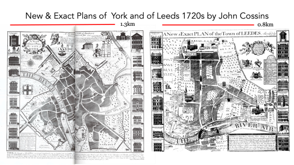
Rachael Unsworth
Thu 19 Nov 2026
York and Leeds: how are these two Yorkshire urban centres linked and what accounts for the differences in the way they have evolved over the centuries?
Heritage
Leeds 400
Talk
Geography is at the root of answering these questions about differential urban development. Rachael Unsworth’s presentation will draw out the main lines of argument and raise some questions about sources and their interpretation.
A Leeds 400 event from the Thoresby Society
18 Commercial Street
Leeds
LS1 6AL
United Kingdom
Show on map
53.797456, -1.544537
Date
Thu 19 Nov 2026
18:00 - 19:00
Tickets
Ticket price
Links
The Thoresby Society
You may also like
City Varieties Music Hall
Literature
Spoken Word
Talk


City Varieties Music Hall
Gigs
Music
Talk